|
|
School Maps and Others Between 1922 and 1973 Eduard
Imhof worked on numerous school maps and wall maps. Besides his
school map of Switzerland
1:500 000 he drew maps for the
Swiss cantons of Aargau, Appenzell, Basel, Bern, Glarus, the
Grisons, Lucerne, Neuchâtel, Schaffhausen, St. Gall,
Ticino and Zurich as well as for the Austrian Province of
Vorarlberg. Sections from different maps are shown, and in
different states, original drawings, separate prints of special
colors a.s.o. By working on these school maps Imhof put his
cartographic theories into practice. |
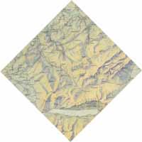
- School map of the Canton of St. Gall 1:150 000
Printed
1926 / Sept. 26, 1927.
Hofer & Co, Kartographische
Anstalt, Zürich. 60 x 50 cm.
First school map made by
Ed. Imhof.
The original draft has been lost. (Imhof, Eduard
D 3.1)
|
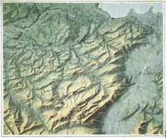
- School map of the Canton of St. Gall 1:150 000
Watercolor
and pen-and-ink. 1920.
Original draft for a competition. 22
x 25 cm.
(Imhof, Eduard O 15)
|
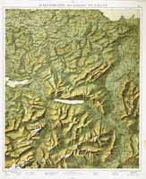
- Relief map of Appenzell country 1:75 000
Original draft.
Watercolor on print of the topographical situation. 1923.
The
map was later reproduced by Hermann Hofer. Various editions.
Outer margin 52 x 63 cm.
(Imhof, Eduard D 4)
|
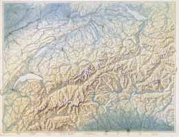
- School map of Switzerland 1:500 000
Watercolor on print
of the topographical situation. 1924.
This map has been
printed in many updated editions since 1925.
Sheet format of
the original painting 55 x 73 cm. Image format of the innermost
frame 53 x 70 cm.
(Imhof, Eduard D 1.1)
|
|